EUDR Compliance: Geospatial Data Pipelines for SA Exporters
Discover how South African agricultural exporters can automate EU Deforestation Regulation (EUDR) compliance using geospatial data pipelines and satellite monitoring to protect EU market access.
The European Union remains South Africa’s largest trading partner, but a significant shift in environmental policy is currently reshaping the landscape of international trade. The European Union Deforestation Regulation (EUDR), which entered into force in June 2023, represents a mandatory due diligence requirement for any business exporting specific commodities into the EU market. For South African agricultural exporters, particularly those dealing in cattle, wood, soya, and rubber, the regulation is no longer a distant policy discussion but a pressing operational challenge. While the European Commission recently proposed a 12-month delay to the implementation—pushing the deadline to December 30, 2025, for large operators and June 30, 2026, for small and medium enterprises (SMEs)—this extension should be viewed as a vital window for technical preparation rather than a reason for complacency.
At its core, the EUDR requires that seven primary commodities—cattle, cocoa, coffee, oil palm, rubber, soya, and wood—as well as many derived products like leather, chocolate, and furniture, be proven deforestation-free. This means the products must not have been produced on land that was subject to deforestation or forest degradation after the cutoff date of December 31, 2020. Crucially, the regulation mandates that exporters provide the exact geolocation of all plots of land where the commodities were produced. For a South African exporter managing a supply chain that involves hundreds or thousands of individual farms, the administrative burden of manual data collection is insurmountable. This is where the automation of geospatial data pipelines becomes a strategic necessity.
THE CHALLENGE OF GEOLOCATION AT SCALE
Article 9 of the EUDR specifies that operators must collect the latitude and longitude coordinates of every production site. For plots larger than four hectares, a simple point coordinate is insufficient; the regulation requires a polygon, a digital map of the farm's exact boundaries. Collecting this data manually via spreadsheets or physical surveys is prone to human error and nearly impossible to verify in real-time. Furthermore, the regulation requires exporters to conduct a risk assessment to ensure that the production is not only deforestation-free but also compliant with the relevant legislation of the country of origin. In South Africa, this includes adherence to land-use rights, environmental protection laws, and labor regulations. Without a centralized digital system, proving this 'chain of custody' from a remote farm in Limpopo or the Eastern Cape to a port in Rotterdam becomes a logistical nightmare.
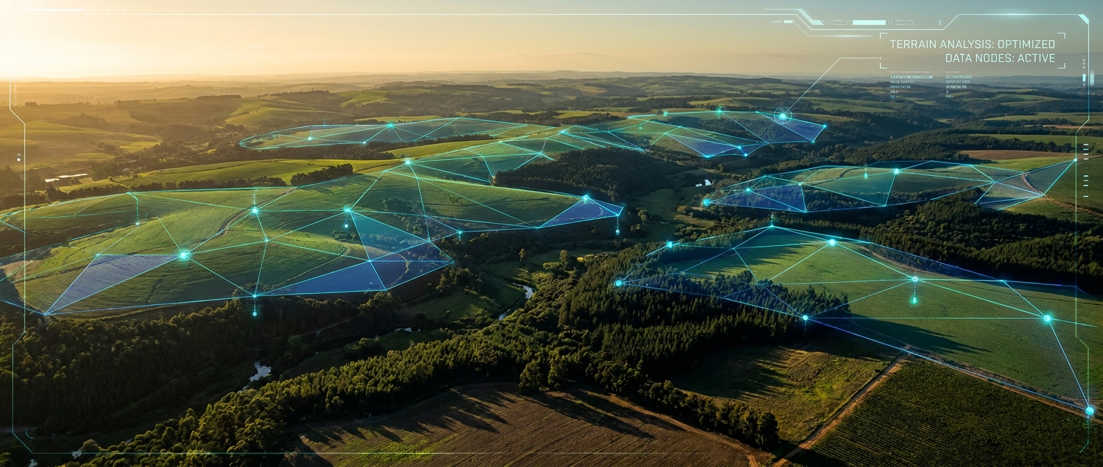
BUILDING THE GEOSPATIAL DATA PIPELINE
A geospatial data pipeline is an automated system that ingests, processes, and analyzes location-based data to provide actionable insights. For EUDR compliance, this pipeline typically leverages three technological pillars: Remote Sensing, Geographic Information Systems (GIS), and Cloud Computing. The process begins with the ingestion of farm boundary data, often captured via mobile GPS tools or existing land registry databases. Once these polygons are uploaded into a cloud environment—such as Amazon Web Services (AWS) or Google Cloud—they are cross-referenced with satellite imagery to monitor land-use changes over time.
South African exporters can leverage high-resolution, open-source data from the European Space Agency’s Sentinel-2 satellites. Sentinel-2 provides 10-meter resolution imagery with a high revisit frequency, allowing for the detection of even minor forest disturbances. By integrating this imagery into a pipeline using tools like Google Earth Engine or Python-based libraries such as GeoPandas and Rasterio, businesses can automate the detection of deforestation. For example, a pipeline can be programmed to calculate the Normalized Difference Vegetation Index (NDVI) for a specific farm polygon and compare it against the 2020 baseline. If a significant drop in vegetation is detected, the system automatically flags the shipment for manual review before it ever reaches the EU border.
THE WHISP METHODOLOGY AND CONVERGENCE OF EVIDENCE
To ensure the highest level of accuracy, many leading tech-forward exporters are adopting the 'Convergence of Evidence' approach. This methodology, supported by the World Resources Institute (WRI) and the UN Food and Agriculture Organization (FAO), suggests that no single data source is definitive. Instead, multiple datasets should be layered to tell the full story of a plot of land. This is often referred to as the WHISP methodology (What IS in that Plot?).
In a South African context, an automated pipeline might layer Sentinel-2 imagery with the Department of Agriculture, Land Reform and Rural Development’s (DALRRD) land-use maps and the Global Forest Watch dataset. By building a custom dashboard that aggregates these sources, exporters can generate a Due Diligence Statement (DDS) with a single click. This digital document contains the geolocation data and the risk assessment results required by the EU’s Information System, which is scheduled to begin accepting registrations in late 2024. Automation ensures that this statement is audit-ready and linked directly to the specific batch or shipment, creating a transparent digital thread from farm to port.
BEYOND COMPLIANCE: OPERATIONAL EFFICIENCY
While the primary driver for building these systems is regulatory compliance, the secondary benefits for South African entrepreneurs are significant. A geospatial data pipeline provides a level of visibility into the supply chain that was previously impossible. Business owners can monitor crop health, predict yields based on historical weather patterns, and optimize logistics by visualizing the physical distance between production clusters and processing facilities. In an era where Environmental, Social, and Governance (ESG) reporting is becoming a standard requirement for securing international investment, having a robust, data-backed sustainability framework is a powerful competitive advantage.
Furthermore, the shift toward automation protects against the 'smallholder exclusion risk.' There is a growing concern that large EU buyers may stop sourcing from small-scale farmers because the cost of verifying their compliance is too high. By implementing low-cost, mobile-friendly data collection tools that feed into a centralized pipeline, South African exporters can empower their smallholder suppliers to remain part of the global value chain. This not only preserves livelihoods but also ensures the long-term resilience of the South African agricultural sector.
IMPLEMENTING THE SOLUTION
Transitioning from manual processes to an automated geospatial pipeline requires a blend of agricultural knowledge and software engineering expertise. The first step for any South African business is to audit their current data: Do you have accurate GPS coordinates for your suppliers? Is that data stored in a structured database or trapped in PDF invoices? Once the data foundation is laid, the focus shifts to building the integration layer that connects your internal systems with satellite providers and the EU’s reporting portals.
As a resource for local businesses navigating this transition, WriteNow Agency specializes in building the custom software and business automation tools required to handle complex data workflows. From developing custom GIS interfaces to implementing AI-driven risk assessment models, our team helps South African exporters turn regulatory hurdles into digital assets. The upcoming EUDR deadlines represent a fundamental change in how the world trades, but for those who embrace the power of geospatial data, it is also an opportunity to lead the way in sustainable, tech-enabled agriculture.
At its core, the EUDR requires that seven primary commodities—cattle, cocoa, coffee, oil palm, rubber, soya, and wood—as well as many derived products like leather, chocolate, and furniture, be proven deforestation-free. This means the products must not have been produced on land that was subject to deforestation or forest degradation after the cutoff date of December 31, 2020. Crucially, the regulation mandates that exporters provide the exact geolocation of all plots of land where the commodities were produced. For a South African exporter managing a supply chain that involves hundreds or thousands of individual farms, the administrative burden of manual data collection is insurmountable. This is where the automation of geospatial data pipelines becomes a strategic necessity.
THE CHALLENGE OF GEOLOCATION AT SCALE
Article 9 of the EUDR specifies that operators must collect the latitude and longitude coordinates of every production site. For plots larger than four hectares, a simple point coordinate is insufficient; the regulation requires a polygon, a digital map of the farm's exact boundaries. Collecting this data manually via spreadsheets or physical surveys is prone to human error and nearly impossible to verify in real-time. Furthermore, the regulation requires exporters to conduct a risk assessment to ensure that the production is not only deforestation-free but also compliant with the relevant legislation of the country of origin. In South Africa, this includes adherence to land-use rights, environmental protection laws, and labor regulations. Without a centralized digital system, proving this 'chain of custody' from a remote farm in Limpopo or the Eastern Cape to a port in Rotterdam becomes a logistical nightmare.
BUILDING THE GEOSPATIAL DATA PIPELINE
A geospatial data pipeline is an automated system that ingests, processes, and analyzes location-based data to provide actionable insights. For EUDR compliance, this pipeline typically leverages three technological pillars: Remote Sensing, Geographic Information Systems (GIS), and Cloud Computing. The process begins with the ingestion of farm boundary data, often captured via mobile GPS tools or existing land registry databases. Once these polygons are uploaded into a cloud environment—such as Amazon Web Services (AWS) or Google Cloud—they are cross-referenced with satellite imagery to monitor land-use changes over time.
South African exporters can leverage high-resolution, open-source data from the European Space Agency’s Sentinel-2 satellites. Sentinel-2 provides 10-meter resolution imagery with a high revisit frequency, allowing for the detection of even minor forest disturbances. By integrating this imagery into a pipeline using tools like Google Earth Engine or Python-based libraries such as GeoPandas and Rasterio, businesses can automate the detection of deforestation. For example, a pipeline can be programmed to calculate the Normalized Difference Vegetation Index (NDVI) for a specific farm polygon and compare it against the 2020 baseline. If a significant drop in vegetation is detected, the system automatically flags the shipment for manual review before it ever reaches the EU border.
THE WHISP METHODOLOGY AND CONVERGENCE OF EVIDENCE
To ensure the highest level of accuracy, many leading tech-forward exporters are adopting the 'Convergence of Evidence' approach. This methodology, supported by the World Resources Institute (WRI) and the UN Food and Agriculture Organization (FAO), suggests that no single data source is definitive. Instead, multiple datasets should be layered to tell the full story of a plot of land. This is often referred to as the WHISP methodology (What IS in that Plot?).
In a South African context, an automated pipeline might layer Sentinel-2 imagery with the Department of Agriculture, Land Reform and Rural Development’s (DALRRD) land-use maps and the Global Forest Watch dataset. By building a custom dashboard that aggregates these sources, exporters can generate a Due Diligence Statement (DDS) with a single click. This digital document contains the geolocation data and the risk assessment results required by the EU’s Information System, which is scheduled to begin accepting registrations in late 2024. Automation ensures that this statement is audit-ready and linked directly to the specific batch or shipment, creating a transparent digital thread from farm to port.
BEYOND COMPLIANCE: OPERATIONAL EFFICIENCY
While the primary driver for building these systems is regulatory compliance, the secondary benefits for South African entrepreneurs are significant. A geospatial data pipeline provides a level of visibility into the supply chain that was previously impossible. Business owners can monitor crop health, predict yields based on historical weather patterns, and optimize logistics by visualizing the physical distance between production clusters and processing facilities. In an era where Environmental, Social, and Governance (ESG) reporting is becoming a standard requirement for securing international investment, having a robust, data-backed sustainability framework is a powerful competitive advantage.
Furthermore, the shift toward automation protects against the 'smallholder exclusion risk.' There is a growing concern that large EU buyers may stop sourcing from small-scale farmers because the cost of verifying their compliance is too high. By implementing low-cost, mobile-friendly data collection tools that feed into a centralized pipeline, South African exporters can empower their smallholder suppliers to remain part of the global value chain. This not only preserves livelihoods but also ensures the long-term resilience of the South African agricultural sector.
IMPLEMENTING THE SOLUTION
Transitioning from manual processes to an automated geospatial pipeline requires a blend of agricultural knowledge and software engineering expertise. The first step for any South African business is to audit their current data: Do you have accurate GPS coordinates for your suppliers? Is that data stored in a structured database or trapped in PDF invoices? Once the data foundation is laid, the focus shifts to building the integration layer that connects your internal systems with satellite providers and the EU’s reporting portals.
As a resource for local businesses navigating this transition, WriteNow Agency specializes in building the custom software and business automation tools required to handle complex data workflows. From developing custom GIS interfaces to implementing AI-driven risk assessment models, our team helps South African exporters turn regulatory hurdles into digital assets. The upcoming EUDR deadlines represent a fundamental change in how the world trades, but for those who embrace the power of geospatial data, it is also an opportunity to lead the way in sustainable, tech-enabled agriculture.

Comments (0)
Leave a Comment